


SW Maps - GIS & Data Collector
SW Maps - GIS & Data Collector介绍
SW Maps 是一款免费的 GIS 和移动地图应用程序,用于收集、呈现和共享地理信息。
无论您是使用高精度仪器进行全面的 GNSS 测量,还是需要仅使用手机收集大量基于位置的数据,或者只是需要在旅途中查看背景地图上带有标签的一些 shapefile,SW Maps 都可以提供这一切都涵盖了。
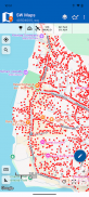
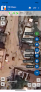
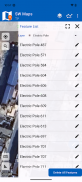
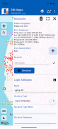
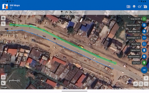
记录点、线、多边形甚至照片,并将它们显示在您选择的背景地图上,并将自定义属性数据附加到任何要素。属性类型包括文本、数字、预定义选项集中的选项、照片、音频剪辑和视频。
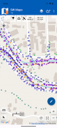
使用支持 RTK 的外部接收器通过蓝牙或 USB 串行进行高精度 GPS 测量。
通过添加标记在地图上绘制要素,并测量距离和面积。
将先前项目的图层和属性重复用于其他调查,或创建模板并与其他用户共享。
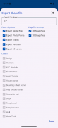
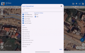
将收集到的数据作为 Geopackage、KMZ 或 shapefile 与其他用户共享,或将其导出到您的设备存储中。还可以将记录的数据共享并导出为电子表格 (XLS/ODS) 或 CSV 文件。
特征
-在线基本地图:Google 地图或 Open Street Map
- 支持多个 mbtile 和 KML 叠加
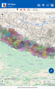
-Shapefile 图层,具有属性分类样式。在 PROJ.4 库支持的任何坐标系中查看 shapefile。
- 添加多个在线 WMTS、TMS、XYZ 或 WMS 图层和缓存切片以供离线使用。
-通过蓝牙或USB串行连接到外部RTK GPS接收器,使用RTK进行高精度测量。还记录来自外部接收器的数据以进行后处理。
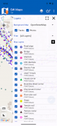
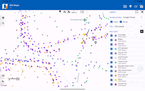
-定义多个要素图层,每个要素图层都有一组自定义属性
要素类型:点、线、多边形
属性类型:文本、数字、下拉选项、清单、照片、音频、视频
另存为模板以供重复使用或共享
-记录GPS轨迹,并进行距离测量
- 在地图上绘制要素并导出为 KMZ、Shapefile、GeoJSON 或 GeoPackages。
-基于属性值的标签特征。
-从模板或现有项目导入要素图层。
- 将收集的数据共享或导出为 KMZ(带有嵌入照片)、shapefile、GeoJSON、Geopackage (GPKG)、XLS/ODS 电子表格或 csv 文件。
- 与其他用户共享模板或项目
- 使用高精度 GNSS 接收器放样地面上的点和线。
该产品在尼泊尔制造,免费(无广告)。如果您觉得这有用,请让您的朋友知道您使用过来自尼泊尔的产品。抽出一些时间来参观这个美妙的国家并了解尼泊尔人民。
SW Maps - GIS & Data Collector - 版本3.0.12.0
(23-04-2025)SW Maps - GIS & Data Collector - APK信息
APK版本: 3.0.12.0程序包: np.com.softwel.swmapsSW Maps - GIS & Data Collector的最新版本
其他版本


同类应用
 4.324.34.074.1


